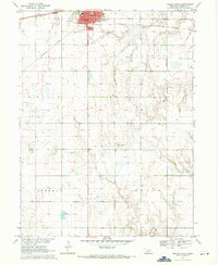
1969 Map of Minden South
USGS Topo · Published 1971About this map
Minden serves as the focal point of this Kearney County landscape, established as a central hub for the surrounding agricultural prairie. The township is well-defined by its civic core, including the St Courthouse, City Hall, and Post Office, which anchor the town grid. A major transport artery, the Burlington Northern railroad, cuts through the northern section of the map, illustrating the vital link between these rural plains and larger markets during the late 1960s.
Find a feature on this map
17 named features on this map. Tap any name to fly to it.
Don’t see what you’re looking for? This feature index may not catch every label — zoom into the map to look around manually.
Map Details
Editions of this 1969 Minden South Map
This is the sole edition of this map. No revisions or reprints were ever made.
Other maps of this area

1894 · Kearney
USGS Topo · 1:62,500

1894 · Minden
USGS Topo · 1:62,500

1896 · Holdrege
USGS Topo · 1:125,000

1896 · Kearney
USGS Topo · 1:125,000

1896 · Wood River
USGS Topo · 1:125,000

1897 · Red Cloud
USGS Topo · 1:125,000

1955 · Grand Island
USGS Topo · 1:250,000

1957 · Grand Island
USGS Topo · 1:250,000

1958 · Grand Island
USGS Topo · 1:250,000

1969 · Upland
USGS Topo · 1:24,000