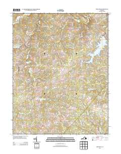
2013 Map of Mine Run
USGS Topo · Published 2013About this map
Wilderness Battlefield occupies the eastern edge of this landscape, marking a terrain defined by complex watercourses and modern residential development. The Rapidan River forms the northern boundary, while the massive Lake of the Woods reservoir anchors the northeast, surrounded by a dense network of suburban streets such as Constitution Blvd and Lakeview Pkwy. These residential patterns contrast with the rural character of the southern and western portions of the quadrangle.
Find a feature on this map
108 named features on this map. Tap any name to fly to it.
Don’t see what you’re looking for? This feature index may not catch every label — zoom into the map to look around manually.
Map Details
Editions of this 2013 Mine Run Map
This is the sole edition of this map. No revisions or reprints were ever made.
Other maps of this area

1887 · Spottsylvania
USGS Topo · 1:125,000

1892 · Spottsylvania
USGS Topo · 1:125,000

1942 · Lahore
USGS Topo · 1:31,680

1942 · Belmont
USGS Topo · 1:31,680

1942 · Brokenburg
USGS Topo · 1:31,680

1943 · Germanna Bridge
USGS Topo · 1:24,000

1943 · Chancellorsville
USGS Topo · 1:24,000

1943 · Culpeper
USGS Topo · 1:24,000

1943 · Mine Run
USGS Topo · 1:24,000

1943 · Unionville
USGS Topo · 1:24,000