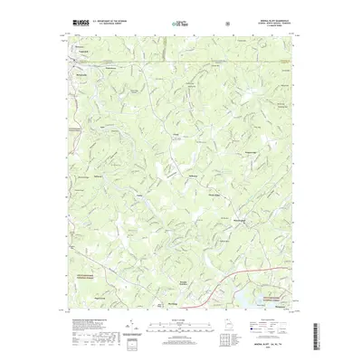
2020 Map of Mineral Bluff
USGS Topo · Published 2020About this map
Toccoa River winding through the North Georgia mountains defines the landscape of this contemporary survey, which documents the tri-state intersection where Georgia, Tennessee, and North Carolina meet. The map reveals a dense network of family-named landmarks and rural cemeteries such as Union Baptist Church Cem and Douthit Cem, which are essential for genealogical research in Fannin and Cherokee Counties. The northern edge highlights the industrial and residential cluster of Copperhill and McCaysville, straddling the state line. Topographical features like Franklin Mtn and Stewart Mtn enclose the agricultural pockets of Hothouse Valley. The southern portion includes the northern reaches of Blue Ridge Lake near Morganton, showing the contemporary recreational and residential development within the Chattahoochee National Forest.
Find a feature on this map
275 named features on this map. Tap any name to fly to it.
Don’t see what you’re looking for? This feature index may not catch every label — zoom into the map to look around manually.
Map Details
Editions of this 2020 Mineral Bluff Map
This is the sole edition of this map. No revisions or reprints were ever made.
Other maps of this area

1888 · Ellijay
USGS Topo · 1:125,000

1892 · Ellijay
USGS Topo · 1:125,000

1893 · Murphy
USGS Topo · 1:125,000

1898 · Ellijay
USGS Topo · 1:125,000

1911 · Ellijay
USGS Topo · 1:125,000

1914 · Murphy
USGS Topo · 1:125,000

1934 · Persimmon Creek
USGS Topo · 1:24,000

1934 · Murphy
USGS Topo · 1:48,000

1935 · Epworth
USGS Topo · 1:24,000

1935 · Mineral Bluff
USGS Topo · 1:24,000