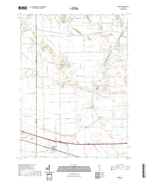
2024 Map of Mineral
USGS Topo · Published 2024About this map
The Henry and Bureau county line bisects this prairie landscape, where an extensive network of drainage infrastructure transformed the local hydrology for agriculture. Numerous waterways like Mineral Marsh Ditch, Goose Pond Ditch, and Roe Ditch Number 2 suggest the historical effort required to manage the low-lying terrain near the Green River. These engineering works, along with the Feeder Basin, dominate the northern and central sections of the quadrangle.
Find a feature on this map
49 named features on this map. Tap any name to fly to it.
Don’t see what you’re looking for? This feature index may not catch every label — zoom into the map to look around manually.
Map Details
Editions of this 2024 Mineral Map
This is the sole edition of this map. No revisions or reprints were ever made.
Other maps of this area

1921 · Buda
USGS Topo · 1:62,500

1923 · Buda
USGS Topo · 1:62,500

1929 · Annawan
USGS Topo · 1:62,500

1932 · Prophetstown
USGS Topo · 1:48,000

1932 · Annawan
USGS Topo · 1:62,500

1936 · Prophetstown
USGS Topo · 1:62,500

1949 · Walnut
USGS Topo · 1:62,500

1958 · Aurora
USGS Topo · 1:250,000

1961 · Aurora
USGS Topo · 1:250,000
1982 · New Bedford
USGS Topo · 1:24,000