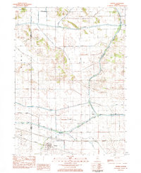
1983 Map of Mineral
USGS Topo · Published 1984About this map
Mineral stands as the primary rail-side settlement in this 1980s landscape, positioned along the Iowa Railroad and flanked by the winding course of Mineral Creek. The map documents a highly managed hydraulic environment where natural watercourses like the Green River and Coal Creek are integrated with an extensive grid of drainage works, including Mineral Marsh Ditch and Goose Pond Ditch. This engineering reflects the region's agricultural intensification and the reclamation of former wetlands.
Find a feature on this map
39 named features on this map. Tap any name to fly to it.
Don’t see what you’re looking for? This feature index may not catch every label — zoom into the map to look around manually.
Map Details
Editions of this 1983 Mineral Map
This is the sole edition of this map. No revisions or reprints were ever made.
Other maps of this area

1921 · Buda
USGS Topo · 1:62,500

1923 · Buda
USGS Topo · 1:62,500

1929 · Annawan
USGS Topo · 1:62,500

1932 · Prophetstown
USGS Topo · 1:48,000

1932 · Annawan
USGS Topo · 1:62,500

1936 · Prophetstown
USGS Topo · 1:62,500

1949 · Walnut
USGS Topo · 1:62,500

1958 · Aurora
USGS Topo · 1:250,000

1961 · Aurora
USGS Topo · 1:250,000
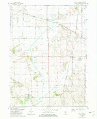
1982 · New Bedford
USGS Topo · 1:24,000