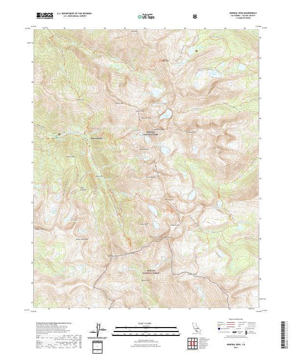
2021 Map of Mineral King
USGS Topo · Published 2021About this map
Mineral King sits deep within the Sequoia National Park and Sequoia National Forest, serving as a focal point for a landscape defined by high-altitude glaciation and early mining history. The map records the remnants of prospecting through names like Miners Ridge and Miners Nose, which overlook the dramatic Farewell Canyon. This area, characterized by the Great Western Divide and the Sierra Nevada crest, features a dense network of alpine water bodies including Columbine Lake, Amphitheater Lake, and the unique Eagle Sinkhole near White Chief Peak. An extensive trail system, such as the Sawtooth Pass Trl and Farewell Gap Trl, connects these remote basins. The inclusion of Aspen Flat and Bullion Flat highlights the rare pockets of level terrain found between the sheer faces of Sawtooth Peak and Vandever Mtn.
Find a feature on this map
83 named features on this map. Tap any name to fly to it.
Don’t see what you’re looking for? This feature index may not catch every label — zoom into the map to look around manually.
Map Details
Editions of this 2021 Mineral King Map
This is the sole edition of this map. No revisions or reprints were ever made.
Other maps of this area

1903 · Tehipite
USGS Topo · 1:125,000

1904 · Kaweah
USGS Topo · 1:125,000

1905 · Tehipite
USGS Topo · 1:125,000

1905 · Olancha
USGS Topo · 1:125,000

1907 · Olancha
USGS Topo · 1:125,000

1907 · Mt. Whitney
USGS Topo · 1:125,000

1909 · Kaweah
USGS Topo · 1:125,000

1919 · Mt. Whitney
USGS Topo · 1:125,000

1937 · Mt. Whitney
USGS Topo · 1:125,000

1937 · Kaweah
USGS Topo · 1:125,000