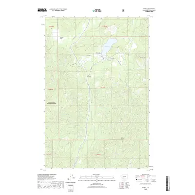
2020 Map of Mineral
USGS Topo · Published 2020About this map
Mineral and its eponymous Mineral Lake serve as the focal point of this Lewis County survey, which documents the area's transition into the Snoqualmie National Forest. The settlement pattern follows the drainages of the Tilton River and Mineral Creek, with small hamlets like Pleasant Valley and Carlson connected by rural routes such as Pleasant Valley Rd and Mineral Rd N. Genealogists will find the Mineral Cem positioned just south of the lake, an important site for family history in this timber-rich region.
Find a feature on this map
36 named features on this map. Tap any name to fly to it.
Don’t see what you’re looking for? This feature index may not catch every label — zoom into the map to look around manually.
Map Details
Editions of this 2020 Mineral Map
This is the sole edition of this map. No revisions or reprints were ever made.
Other maps of this area

1937 · Eatonville
USGS Topo · 1:125,000

1941 · Tanwax Lake
USGS Topo · 1:62,500

1944 · Ohop Valley
USGS Topo · 1:62,500

1949 · Ohop Valley
USGS Topo · 1:62,500

1953 · Hoquiam
USGS Topo · 1:250,000

1956 · Mineral
USGS Topo · 1:62,500

1956 · Kapowsin
USGS Topo · 1:62,500

1957 · Hoquiam
USGS Topo · 1:250,000

1957 · Morton
USGS Topo · 1:62,500

1958 · Hoquiam
USGS Topo · 1:250,000