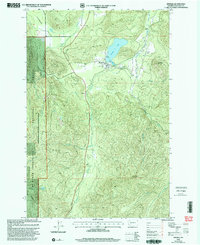
1998 Map of Mineral
USGS Topo · Published 2003About this map
Mineral lies at the heart of this landscape, situated near the western shore of Mineral Lake. The town's layout in the late 1990s includes a localized Mobile Home Park, several Boat Ramps, and a Cem overlooking the water. To the south, the small settlement of Carlson sits along the Tilton River, marking a shift toward the more vertical terrain defined by Storm King Mountain and Roundup Mountain.
Find a feature on this map
25 named features on this map. Tap any name to fly to it.
Don’t see what you’re looking for? This feature index may not catch every label — zoom into the map to look around manually.
Map Details
Editions of this 1998 Mineral Map
This is the sole edition of this map. No revisions or reprints were ever made.
Other maps of this area

1937 · Eatonville
USGS Topo · 1:125,000

1941 · Tanwax Lake
USGS Topo · 1:62,500

1944 · Ohop Valley
USGS Topo · 1:62,500

1949 · Ohop Valley
USGS Topo · 1:62,500

1953 · Hoquiam
USGS Topo · 1:250,000

1956 · Mineral
USGS Topo · 1:62,500

1956 · Kapowsin
USGS Topo · 1:62,500

1957 · Hoquiam
USGS Topo · 1:250,000

1957 · Morton
USGS Topo · 1:62,500

1958 · Hoquiam
USGS Topo · 1:250,000