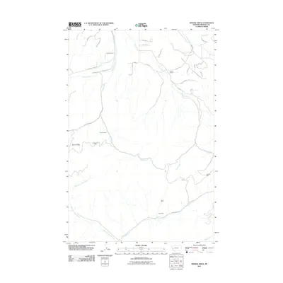
2011 Map of Mineral Ridge
USGS Topo · Published 2011About this map
Mineral Ridge dominates this Missoula County landscape, a terrain defined by its complex drainage systems and a legacy of small-scale resource extraction. The map reveals a network of mountain roads and remote industrial sites, including the Charcoal Mine and SW Section 10 Mine along the slopes near Ashby Creek. Further south, the Linton Mine is positioned near Cramer Creek Road, while the Chloride Mine sits tucked away in the eastern reaches above Camas Creek. These sites, alongside the remote Camas Airport, suggest a landscape where mineral interests and isolated airstrips provide the primary points of human activity amidst the dense topography. The intricate hydrology is led by West Fork Cramer Creek and Blixit Creek, which carve through the high country where local travel is facilitated by named tracks like Top O Deep Road and Coloma Way.
Find a feature on this map
42 named features on this map. Tap any name to fly to it.
Don’t see what you’re looking for? This feature index may not catch every label — zoom into the map to look around manually.
Map Details
Editions of this 2011 Mineral Ridge Map
This is the sole edition of this map. No revisions or reprints were ever made.
Other maps of this area

1903 · Bonner
USGS Topo · 1:125,000

1919 · Drummond
USGS Topo · 1:125,000

1921 · Drummond
USGS Topo · 1:125,000

1947 · Butte
USGS Topo · 1:250,000

1958 · Butte
USGS Topo · 1:250,000

1959 · Bearmouth
USGS Topo · 1:62,500

1959 · Ravenna
USGS Topo · 1:62,500

1960 · Butte
USGS Topo · 1:250,000

1962 · Butte
USGS Topo · 1:250,000

1965 · Union Peak
USGS Topo · 1:24,000