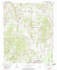
1951 Map of Mineral Springs North
USGS Topo · Published 1983About this map
The Mineral Springs area of Howard County is defined by a landscape of creeks and rural congregation points as mapped in the early 1950s. The northern outskirts of the town are served by the Graysonia Nashville and Ashdown railroad, which parallels Mine Creek along the eastern boundary. This era of settlement is marked by a high density of country churches and family burial grounds, such as York Chapel, Trinity Ch, and the County Line Cem.
Find a feature on this map
28 named features on this map. Tap any name to fly to it.
Don’t see what you’re looking for? This feature index may not catch every label — zoom into the map to look around manually.
Map Details
Editions of this 1951 Mineral Springs North Map
3 editions found
Other maps of this area

1906 · Caddo Gap
USGS Topo · 1:125,000

1913 · De Queen
USGS Topo · 1:125,000

1950 · Mcalester
USGS Topo · 1:250,000

1950 · Ben Lomond
USGS Topo · 1:24,000

1951 · Ben Lomond
USGS Topo · 1:24,000

1951 · Mineral Springs South
USGS Topo · 1:24,000

1951 · Columbus
USGS Topo · 1:24,000

1951 · Mineral Springs North
USGS Topo · 1:24,000

1951 · Nashville
USGS Topo · 1:24,000

1951 · Silver Ridge
USGS Topo · 1:24,000