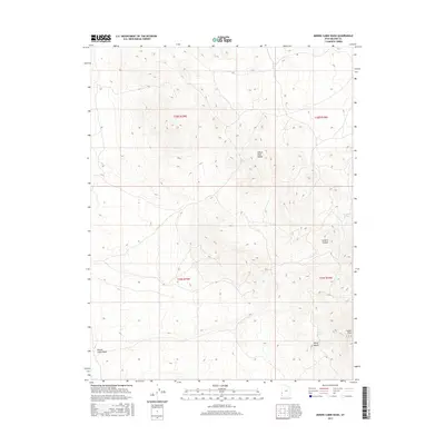
2017 Map of Miners Cabin Wash
USGS Topo · Published 2017About this map
The Indian Peak Range dominates this portion of Beaver County, Utah, providing a detailed view of the high-elevation drainage systems and prominent summits of the Great Basin. This 2017 survey documents a landscape defined by sharp topographic reliefs, featuring distinctive landmarks such as Marys Nipple and the high point of Indian Peak. The map highlights the essential water sources in this arid environment, including Ryan Spring, Chokecherry Spring, and Willow Spring, which have historically served as vital points for livestock and wildlife. The namesake Miners Cabin Wash in the southwest corner suggests a history of human activity and transient settlement tied to the region's mineral interests. From the depths of Greens Canyon to the ephemeral flow of Indian Cr, the map provides a precise record of the natural corridor and public land boundaries during the early 21st century.
Find a feature on this map
13 named features on this map. Tap any name to fly to it.
Don’t see what you’re looking for? This feature index may not catch every label — zoom into the map to look around manually.
Map Details
Editions of this 2017 Miners Cabin Wash Map
This is the sole edition of this map. No revisions or reprints were ever made.
Other maps of this area

1953 · Richfield
USGS Topo · 1:250,000

1956 · Lund
USGS Topo · 1:250,000

1958 · Richfield
USGS Topo · 1:250,000

1960 · Lund
USGS Topo · 1:250,000

1971 · Pinto Spring
USGS Topo · 1:24,000

1971 · Sawtooth Peak
USGS Topo · 1:24,000

1971 · Atchison Creek
USGS Topo · 1:24,000

1972 · Gleason Basin
USGS Topo · 1:24,000

1972 · Hamlin Well
USGS Topo · 1:24,000

1972 · White Rock Peak
USGS Topo · 1:24,000