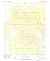
1972 Map of Miners Cabin Wash
USGS Topo · Published 1975About this map
The Indian Peak range dominates this 1970s landscape, where remote mining claims and high-altitude water sources define the human geography of Beaver County. Evidence of mid-century exploration is scattered throughout the terrain, most notably at the Blue Jay Mine and several unnamed prospects located south of Greens Canyon. These extraction sites are linked by a network of jeep trails that traverse the ridges near landmarks like Marys Nipple.
Find a feature on this map
19 named features on this map. Tap any name to fly to it.
Don’t see what you’re looking for? This feature index may not catch every label — zoom into the map to look around manually.
Map Details
Editions of this 1972 Miners Cabin Wash Map
This is the sole edition of this map. No revisions or reprints were ever made.
Other maps of this area

1953 · Richfield
USGS Topo · 1:250,000

1956 · Lund
USGS Topo · 1:250,000

1958 · Richfield
USGS Topo · 1:250,000

1960 · Lund
USGS Topo · 1:250,000

1971 · Pinto Spring
USGS Topo · 1:24,000

1971 · Sawtooth Peak
USGS Topo · 1:24,000

1971 · Atchison Creek
USGS Topo · 1:24,000

1972 · Gleason Basin
USGS Topo · 1:24,000

1972 · Hamlin Well
USGS Topo · 1:24,000

1972 · White Rock Peak
USGS Topo · 1:24,000