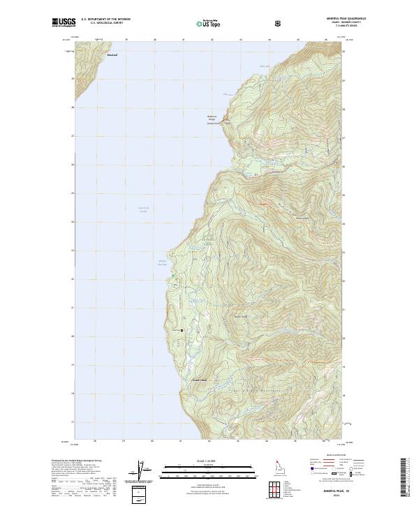
2024 Map of Minerva Peak
USGS Topo · Published 2024About this map
Lake Pend Oreille dominates the western portion of this Idaho landscape, its shoreline carved into numerous inlets like Whiskey Rock Bay and Kilroy Bay. The terrain rises sharply from the water into the Kaniksu National Forest, where the high peaks of the Bitterroot Range and Coeur d'Alene Mountains meet. Local history is anchored by the small settlement of Blacktail in the north and the Clara Cem located along Johnson Creek Rd. The map reveals a complex network of forest access routes, including the Minerva Ridge Trl and Packsaddle Mountain Trl, which navigate the steep elevation changes around Minerva Peak and Barton Hump. This survey illustrates the modern intersection of recreational access and rugged Idaho wilderness, preserving the locations of remote mountain ridges and secluded shoreline coves.
Find a feature on this map
38 named features on this map. Tap any name to fly to it.
Don’t see what you’re looking for? This feature index may not catch every label — zoom into the map to look around manually.
Map Details
Editions of this 2024 Minerva Peak Map
This is the sole edition of this map. No revisions or reprints were ever made.
Other maps of this area

1901 · Sandpoint
USGS Topo · 1:125,000

1903 · Rathdrum
USGS Topo · 1:125,000

1909 · Cataldo
USGS Topo · 1:125,000

1911 · Cataldo
USGS Topo · 1:125,000

1911 · Priest Lake
USGS Topo · 1:250,000

1911 · Sandpoint
USGS Topo · 1:125,000

1913 · Priest Lake
USGS Topo · 1:250,000

1949 · Packsaddle Mtn
USGS Topo · 1:62,500

1951 · Packsaddle Mtn
USGS Topo · 1:62,500

1955 · Spokane
USGS Topo · 1:250,000