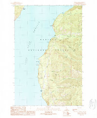
1989 Map of Minerva Peak
USGS Topo · Published 1989About this map
Pend Oreille Lake dominates the western half of this North Idaho landscape, where the shoreline meets the steep, timbered slopes of the Kaniksu National Forest. In the late 1980s, this area remained largely defined by its isolation and industrial history, evidenced by the Minerva Mine and Falls Creek Mine tucked into the mountain drainages. Small lakeside settlements like Blacktail and Kilroy serve as anchor points along the rugged eastern shore, connected by limited roads and a Footbridge over Granite Creek.
Find a feature on this map
35 named features on this map. Tap any name to fly to it.
Don’t see what you’re looking for? This feature index may not catch every label — zoom into the map to look around manually.
Map Details
Editions of this 1989 Minerva Peak Map
This is the sole edition of this map. No revisions or reprints were ever made.
Other maps of this area

1901 · Sandpoint
USGS Topo · 1:125,000

1903 · Rathdrum
USGS Topo · 1:125,000

1909 · Cataldo
USGS Topo · 1:125,000

1911 · Cataldo
USGS Topo · 1:125,000

1911 · Priest Lake
USGS Topo · 1:250,000

1911 · Sandpoint
USGS Topo · 1:125,000

1913 · Priest Lake
USGS Topo · 1:250,000

1949 · Packsaddle Mtn
USGS Topo · 1:62,500

1951 · Packsaddle Mtn
USGS Topo · 1:62,500

1955 · Spokane
USGS Topo · 1:250,000