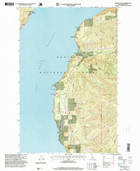
1996 Map of Minerva Peak
USGS Topo · Published 1999About this map
Lake Pend Oreille dominates the western edge of this landscape, its deep waters meeting the steep, timbered slopes of the Kaniksu National Forest. The rugged shoreline is punctuated by small outposts and landmarks such as Blacktail, Whiskey Rock, and the isolated Clara Cemetery near the settlement of Ethel. These points, along with Cedar and Minerva, suggest a history of lakeside residency and transit before modern road networks reached these interior reaches.
Find a feature on this map
39 named features on this map. Tap any name to fly to it.
Don’t see what you’re looking for? This feature index may not catch every label — zoom into the map to look around manually.
Map Details
Editions of this 1996 Minerva Peak Map
This is the sole edition of this map. No revisions or reprints were ever made.
Other maps of this area

1901 · Sandpoint
USGS Topo · 1:125,000

1903 · Rathdrum
USGS Topo · 1:125,000

1909 · Cataldo
USGS Topo · 1:125,000

1911 · Cataldo
USGS Topo · 1:125,000

1911 · Priest Lake
USGS Topo · 1:250,000

1911 · Sandpoint
USGS Topo · 1:125,000

1913 · Priest Lake
USGS Topo · 1:250,000

1949 · Packsaddle Mtn
USGS Topo · 1:62,500

1951 · Packsaddle Mtn
USGS Topo · 1:62,500

1955 · Spokane
USGS Topo · 1:250,000