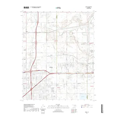
2019 Map of Mingo
USGS Topo · Published 2019About this map
Bird Creek and its southern tributaries, including Mingo Creek and Spunky Creek, define the northern drainage of this landscape as it meets the urban expansion of Tulsa. The map details a complex transition from high-density suburban development to the industrial and natural features of the northeast Oklahoma plains. Significant transportation hubs are prominent, including the large expanse of the Tulsa International Airport and the smaller Harvey Young Airport. The industrial character of the area is underscored by the BNSF Railway and a large Rock Quarry near Garnett. Genealogists will find interest in localized burial grounds such as Harlow Cem, Grayson Cem, and Denbo Cem, while the terrain is marked by distinct rises like Hooper Hill and Goat Hill near the Catoosa border.
Find a feature on this map
98 named features on this map. Tap any name to fly to it.
Don’t see what you’re looking for? This feature index may not catch every label — zoom into the map to look around manually.
Map Details
Editions of this 2019 Mingo Map
This is the sole edition of this map. No revisions or reprints were ever made.
Other maps of this area

1901 · Claremore
USGS Topo · 1:125,000

1914 · Claremore
USGS Topo · 1:125,000

1916 · Claremore
USGS Topo · 1:125,000

1952 · Jenks
USGS Topo · 1:24,000

1954 · Tulsa
USGS Topo · 1:250,000

1954 · Tulsa
USGS Topo · 1:24,000

1955 · Sperry
USGS Topo · 1:24,000

1955 · Mingo
USGS Topo · 1:24,000

1955 · Broken Arrow
USGS Topo · 1:24,000

1956 · Collinsville
USGS Topo · 1:24,000