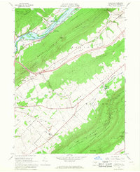
1966 Map of Mingoville
USGS Topo · Published 1968About this map
Howard Reservoir dominates the northern valley of this 1960s landscape, where Blanchard Creek and Bald Eagle Creek meet beneath the steep slopes of Bald Eagle Mountain. The map reveals a transition in the local economy, showing active industrial sites like a Shale Pit and Quarry alongside the Furnace Ruins near Curtin. Agriculture and recreation define the central plains of Nittany Valley, anchored by the Nittany Country Club and the small settlements of Zion and Mingoville.
Find a feature on this map
45 named features on this map. Tap any name to fly to it.
Don’t see what you’re looking for? This feature index may not catch every label — zoom into the map to look around manually.
Map Details
Editions of this 1966 Mingoville Map
4 editions found
Other maps of this area

1908 · Bellefonte
USGS Topo · 1:62,500

1909 · Bellefonte
USGS Topo · 1:62,500

1921 · Howard
USGS Topo · 1:48,000

1923 · Howard
USGS Topo · 1:62,500

1924 · Centre Hall
USGS Topo · 1:62,500

1928 · Snow Shoe
USGS Topo · 1:48,000

1929 · Centre Hall
USGS Topo · 1:62,500

1931 · Show Shoe
USGS Topo · 1:62,500

1943 · Lewistown
USGS Topo · 1:125,000

1950 · Harrisburg
USGS Topo · 1:250,000