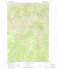
1966 Map of Mink Peak
USGS Topo · Published 1986About this map
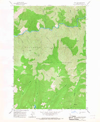
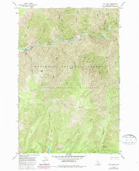
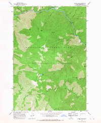
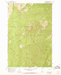
Selway River flows through the northern reaches of this Idaho interior, a landscape defined by high ridges and deep drainage systems in the Nezperce National Forest. The geography is shaped by water, from the geothermal activity at Marten Hot Springs to the high-elevation Doe Lake in the southern sector. A complex network of Pack Trails provides the primary means of traversal through the Selway-Bitterroot Wilderness, connecting landmarks such as Sixtytwo Ridge and Meeker Ridge.
Find a feature on this map
26 named features on this map. Tap any name to fly to it.
Don’t see what you’re looking for? This feature index may not catch every label — zoom into the map to look around manually.
Map Details
Editions of this 1966 Mink Peak Map
Other maps of this area

1911 · Lolo
USGS Topo · 1:250,000

1913 · Lolo
USGS Topo · 1:250,000

1956 · Elk City
USGS Topo · 1:250,000

1956 · Hamilton
USGS Topo · 1:250,000

1959 · Hamilton
USGS Topo · 1:250,000

1960 · Elk City
USGS Topo · 1:250,000

1960 · Hamilton
USGS Topo · 1:250,000

1964 · Hamilton
USGS Topo · 1:250,000
1966 · Moose Ridge
USGS Topo · 1:24,000
1966 · Wylies Peak
USGS Topo · 1:24,000