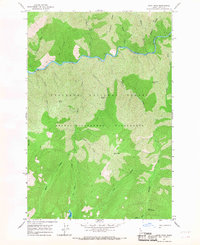
1966 Map of Mink Peak
USGS Topo · Published 1968About this map
The Selway River cuts a deep course through this interior portion of the Nez Perce National Forest during the mid-1960s, a landscape defined by its lack of roads and reliance on a network of Pack Trails. The terrain is dominated by prominent high points such as Mink Peak and Weasel Point, with dramatic drainage systems like Three Links Creek and Tango Creek feeding into the main river channel. Within the Selway Bitterroot Wilderness, the map identifies localized features of interest for backcountry historians, including the Marten Hot Springs and the remote waters of Doe Lake. The presence of river markers like Mile 130 and naming conventions such as Sixtytwo Ridge and Meeker Ridge reflect the systematic surveying of this unpopulated Idaho backcountry before modern digital mapping, preserving the specific trail alignments used by forest rangers and early recreationalists.
Find a feature on this map
28 named features on this map. Tap any name to fly to it.
Don’t see what you’re looking for? This feature index may not catch every label — zoom into the map to look around manually.
Map Details
Editions of this 1966 Mink Peak Map
Other maps of this area

1911 · Lolo
USGS Topo · 1:250,000

1913 · Lolo
USGS Topo · 1:250,000

1956 · Elk City
USGS Topo · 1:250,000

1956 · Hamilton
USGS Topo · 1:250,000

1959 · Hamilton
USGS Topo · 1:250,000

1960 · Elk City
USGS Topo · 1:250,000

1960 · Hamilton
USGS Topo · 1:250,000

1964 · Hamilton
USGS Topo · 1:250,000

1966 · Moose Ridge
USGS Topo · 1:24,000
1966 · Wylies Peak
USGS Topo · 1:24,000