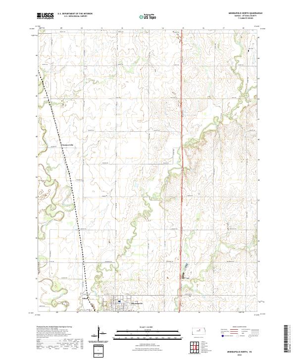
2022 Map of Minneapolis North
USGS Topo · Published 2022About this map
Minneapolis serves as the focal point of this northern Ottawa County landscape, situated where the Solomon River meets Lindsey Cr and Pipe Cr. The township layout is defined by a rigorous grid of section-line roads, including Treaty Rd and Pioneer Rd, which facilitate transport through this agricultural heartland. To the northwest, the small settlement of Summerville sits along the winding course of the Solomon River, while the locale of Alfmil is positioned near the rail corridor indicated by Railroad St. Genealogists may find interest in the isolated Hall Cem located in the northeast, positioned above W Pipe Cr. The map illustrates a stable rural economy where local geography is dominated by drainage patterns like those of Oxbow Rd and the persistent influence of the river system on the region's development.
Find a feature on this map
52 named features on this map. Tap any name to fly to it.
Don’t see what you’re looking for? This feature index may not catch every label — zoom into the map to look around manually.
Map Details
Editions of this 2022 Minneapolis North Map
This is the sole edition of this map. No revisions or reprints were ever made.
Other maps of this area

1892 · Minneapolis
USGS Topo · 1:125,000

1952 · Glasco
USGS Topo · 1:24,000

1955 · Manhattan
USGS Topo · 1:250,000

1956 · Manhattan
USGS Topo · 1:250,000

1957 · Manhattan
USGS Topo · 1:250,000

1961 · Tescott NE
USGS Topo · 1:24,000

1964 · Lamar
USGS Topo · 1:24,000
1965 · Minneapolis South
USGS Topo · 1:24,000

1965 · Minneapolis North
USGS Topo · 1:24,000
1965 · Aurora SW
USGS Topo · 1:24,000