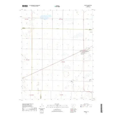
2018 Map of Minneola
USGS Topo · Published 2018About this map
Minneola serves as the central hub on this southwest Kansas landscape, situated near the intersection of Clark, Meade, and Ford counties. The town's grid is clearly defined by streets such as W Ash St, W Locust St, and Spruce St, flanked by W Front St and E Front St which parallel the diagonal transportation route through the territory. Outside the residential center, the geography is marked by numerous prairie potholes and wetlands that dot the agricultural plains. To the southeast, the Appleton Township Cem provides a genealogical touchpoint for the area. Aviation footprints are visible at Amy Airport and Kraemer Airfield, reflecting the importance of private air travel in this rural region. The drainage of Bluff Cr cuts through the northeastern corner, indicating the natural water flow across the high plains terrain.
Find a feature on this map
36 named features on this map. Tap any name to fly to it.
Don’t see what you’re looking for? This feature index may not catch every label — zoom into the map to look around manually.
Map Details
Editions of this 2018 Minneola Map
This is the sole edition of this map. No revisions or reprints were ever made.
Other maps of this area

1892 · Meade
USGS Topo · 1:125,000

1892 · Dodge
USGS Topo · 1:125,000

1892 · Spearville
USGS Topo · 1:125,000

1894 · Spearville
USGS Topo · 1:125,000

1896 · Ashland
USGS Topo · 1:125,000

1955 · Pratt
USGS Topo · 1:250,000

1955 · Dodge City
USGS Topo · 1:250,000

1958 · Dodge City
USGS Topo · 1:250,000

1959 · Pratt
USGS Topo · 1:250,000

1959 · Dodge City
USGS Topo · 1:250,000