1971 Map of Minneola
USGS Topo · Published 1992About this map
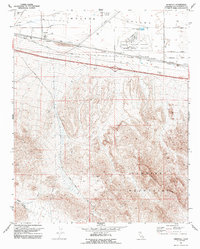
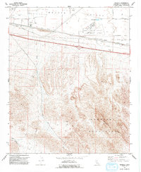
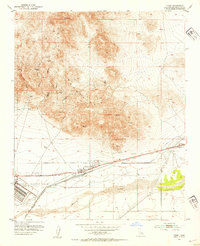
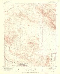
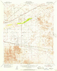
The Mojave Valley floor and the rising northern slopes of the Newberry Mountains dominate this 1971 landscape, where industrial and military infrastructure meet the high desert. The northern reaches are characterized by the Barstow Daggett Airport and the sprawling Marine Corps Supply Center, which reflect the region's strategic importance during the mid-century. Transportation corridors are central to the area's development, with the National Trails Highway and numerous utility lines like the Gale Pipeline cutting across the valley floor. To the south, the terrain becomes increasingly complex as the Minneola Ridge and Daggett Wash define the drainage patterns toward the mountains. Evidence of resource extraction is found at the Azucar Mine, while local utilities are marked by a Powerplant and Sewage Disposal Ponds. The presence of a Private Road network and several borrow pits suggests an era of active construction and land management.
Find a feature on this map
22 named features on this map. Tap any name to fly to it.
Don’t see what you’re looking for? This feature index may not catch every label — zoom into the map to look around manually.
Map Details
Editions of this 1971 Minneola Map
2 editions found
Other maps of this area

1953 · San Bernardino
USGS Topo · 1:250,000
1953 · Yermo
USGS Topo · 1:24,000
1953 · Nebo
USGS Topo · 1:24,000
1955 · Newberry
USGS Topo · 1:62,500
1955 · Ord Mountains
USGS Topo · 1:62,500
1955 · Rodman Mountains
USGS Topo · 1:62,500

1956 · San Bernardino
USGS Topo · 1:250,000
1956 · Daggett
USGS Topo · 1:62,500

1957 · San Bernardino
USGS Topo · 1:250,000

1958 · San Bernardino
USGS Topo · 1:250,000