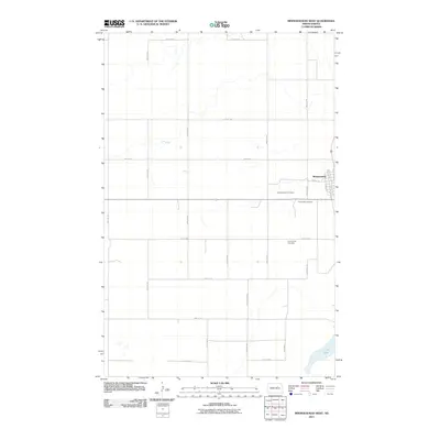
2011 Map of Minnewaukan West
USGS Topo · Published 2011About this map
Minnewaukan sits at the eastern edge of this landscape, its residential grid defined by streets like Main St W and West Ave N. The surrounding Benson County terrain is a vast expanse of section lines and rural crossroads, where the local history is preserved in several burial grounds. Researchers will find the Minnewaukan Cemetery and Saint Peter Cemetery just south of the town center, while the Free Church Cemetery is located further south along 63rd Ave NE. The southeastern corner is dominated by the waters of Long Lake, a significant local landmark. This 2011 survey by the U.S. Geological Survey shows a transition in the regional transportation network, with Highway 281 and Highway 19 serving as the primary arteries through the agricultural heartland, complemented by a strict grid of gravel roads like 47th St NE.
Find a feature on this map
26 named features on this map. Tap any name to fly to it.
Don’t see what you’re looking for? This feature index may not catch every label — zoom into the map to look around manually.
Map Details
Editions of this 2011 Minnewaukan West Map
This is the sole edition of this map. No revisions or reprints were ever made.
Other maps of this area

1931 · Oberon
USGS Topo · 1:62,500

1932 · Flora
USGS Topo · 1:62,500

1932 · Grahams Island
USGS Topo · 1:62,500

1950 · Grahams Island
USGS Topo · 1:62,500

1950 · Oberon
USGS Topo · 1:62,500

1951 · Oberon
USGS Topo · 1:24,000

1951 · Tilden
USGS Topo · 1:24,000

1951 · Minnewaukan East
USGS Topo · 1:24,000

1951 · Flora
USGS Topo · 1:24,000

1951 · Josephine
USGS Topo · 1:24,000