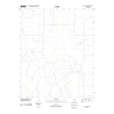
2010 Map of Minnow Creek
USGS Topo · Published 2010About this map
Minnow Creek and Deer Creek carve through the section-line grid of western Oklahoma in this Beckham County landscape. The area is defined by a strictly organized network of section roads, including E 1310 Rd and N 1740 Rd, which cut across the natural drainage patterns of Fish Creek and Root Creek. This map reflects the enduring land-run geometry of the Great Plains, where the rural transportation grid remains the dominant human imprint on the terrain. The presence of these small watercourses amidst the agricultural blocks indicates the essential riparian corridors that shaped early settlement and ranching in the region, providing a detailed look at the rural geography as it existed in the first decade of the 21st century.
Find a feature on this map
17 named features on this map. Tap any name to fly to it.
Don’t see what you’re looking for? This feature index may not catch every label — zoom into the map to look around manually.
Map Details
Editions of this 2010 Minnow Creek Map
This is the sole edition of this map. No revisions or reprints were ever made.
Other maps of this area

1955 · Lawton
USGS Topo · 1:250,000

1955 · Clinton
USGS Topo · 1:250,000

1957 · Clinton
USGS Topo · 1:250,000

1961 · Willow
USGS Topo · 1:62,500

1961 · Erick
USGS Topo · 1:62,500
1971 · Madge
USGS Topo · 1:24,000

1971 · Vinson
USGS Topo · 1:24,000

1971 · Reed
USGS Topo · 1:24,000

1985 · Elk City
USGS Topo · 1:100,000

1985 · Altus
USGS Topo · 1:100,000