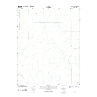
2012 Map of Minnow Creek
USGS Topo · Published 2012About this map
Doc Hollis Lake anchors the southern edge of this Oklahoma landscape, where the high plains transition into a network of seasonal drainages. The area is defined by the headwaters and winding paths of Minnow Cr and Deer Cr, which carve subtle topography through the countryside. This terrain is systematically organized by a grid of rural roads, including N1770 Rd and E1330 Rd, reflecting the classic section-line development typical of the western Oklahoma prairie. Other smaller tributaries like Fish Cr and Root Cr weave through the northern and southern sectors, illustrating the natural drainage patterns that have historically dictated land use and ranching boundaries in this region.
Find a feature on this map
19 named features on this map. Tap any name to fly to it.
Don’t see what you’re looking for? This feature index may not catch every label — zoom into the map to look around manually.
Map Details
Editions of this 2012 Minnow Creek Map
This is the sole edition of this map. No revisions or reprints were ever made.
Other maps of this area

1955 · Lawton
USGS Topo · 1:250,000

1955 · Clinton
USGS Topo · 1:250,000

1957 · Clinton
USGS Topo · 1:250,000

1961 · Willow
USGS Topo · 1:62,500

1961 · Erick
USGS Topo · 1:62,500
1971 · Madge
USGS Topo · 1:24,000

1971 · Vinson
USGS Topo · 1:24,000

1971 · Reed
USGS Topo · 1:24,000

1985 · Elk City
USGS Topo · 1:100,000

1985 · Altus
USGS Topo · 1:100,000