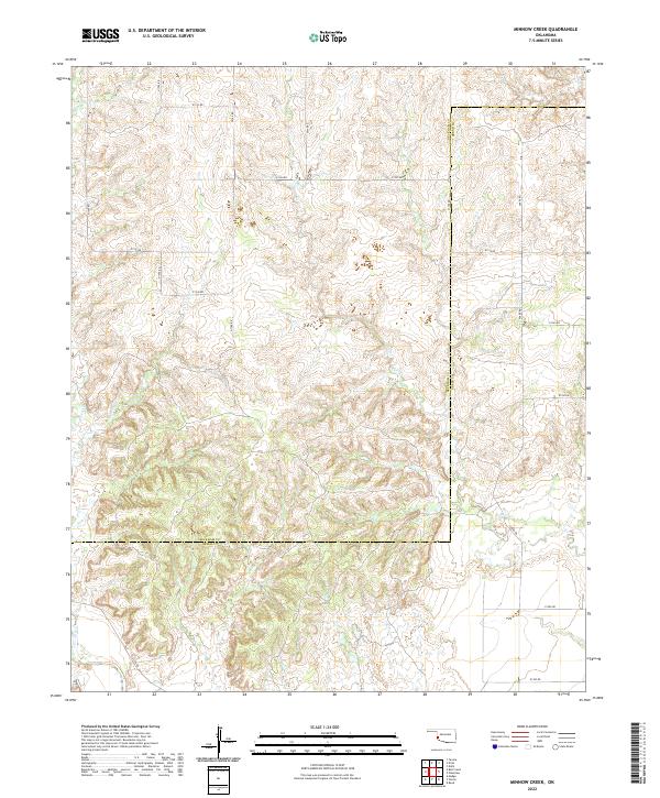
2022 Map of Minnow Creek
USGS Topo · Published 2022About this map
Minnow Creek flows through a dissected landscape of red-dirt drainage basins along the southern border of Beckham County. This modern survey illustrates the persistent section-line road grid that defines the Oklahoma prairie, where routes like N1760 Road and E1330 Road provide the primary access to cattle-grazing land and rural homesteads. The terrain is defined by the headwaters of several drainages, including Fish Creek in the west and Deer Creek in the east, which carve intricate contour patterns into the plains. The southern margin of the map traces the political boundary with Greer County, showing how the land was organized into townships like t7n r25w and t7n r24w. This quadrangle is primarily an agricultural and hydrological study, documenting the small seasonal streams like Root Creek that feed into the larger regional watershed.
Find a feature on this map
26 named features on this map. Tap any name to fly to it.
Don’t see what you’re looking for? This feature index may not catch every label — zoom into the map to look around manually.
Map Details
Editions of this 2022 Minnow Creek Map
This is the sole edition of this map. No revisions or reprints were ever made.
Other maps of this area

1955 · Lawton
USGS Topo · 1:250,000

1955 · Clinton
USGS Topo · 1:250,000

1957 · Clinton
USGS Topo · 1:250,000

1961 · Willow
USGS Topo · 1:62,500

1961 · Erick
USGS Topo · 1:62,500
1971 · Madge
USGS Topo · 1:24,000

1971 · Vinson
USGS Topo · 1:24,000

1971 · Reed
USGS Topo · 1:24,000

1985 · Elk City
USGS Topo · 1:100,000

1985 · Altus
USGS Topo · 1:100,000