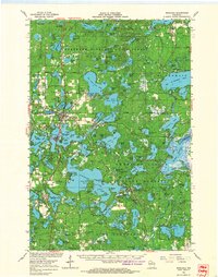
1966 Map of Minocqua
USGS Topo · Published 1968About this map
Minocqua and its neighboring lakefront settlements are depicted here in the mid-1960s, a landscape defined by an intricate network of glacial lakes and northern forests. This survey showcases the dense concentration of recreation and early tourism infrastructure, including the Lakeland Municipal Airport, several campgrounds like Indian Mound Campground, and even a Drive-in Theater. The map captures a moment of transition for regional transportation, showing the Chicago And North Western and Milwaukee Road railroads alongside the developing highway system of U. S. 51 and Wis. 70.
Find a feature on this map
143 named features on this map. Tap any name to fly to it.
Don’t see what you’re looking for? This feature index may not catch every label — zoom into the map to look around manually.
Map Details
Editions of this 1966 Minocqua Map
2 editions found
Other maps of this area

1930 · Robbins
USGS Topo · 1:48,000

1938 · Minocqua
USGS Topo · 1:48,000

1938 · Robbins
USGS Topo · 1:48,000

1938 · Lac Du Flambeau
USGS Topo · 1:48,000

1939 · Trout Lake
USGS Topo · 1:48,000

1939 · Lac Du Flambeau
USGS Topo · 1:48,000

1939 · Mc Cord
USGS Topo · 1:48,000

1939 · Winchester
USGS Topo · 1:48,000

1939 · Cassian
USGS Topo · 1:48,000

1940 · Rhinelander
USGS Topo · 1:48,000