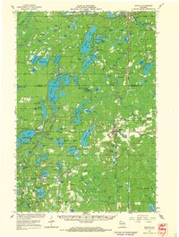
1965 Map of Minong
USGS Topo · Published 1967About this map
Minong and Wascott serve as the primary hubs in this mid-1960s study of Washburn and Douglas Counties. The landscape is defined by its extensive water network, including the Minong Flowage and the St Croix River, which supported local industry and recreation. Transport and logistics are anchored by the Chicago and North Western railroad corridor, while smaller infrastructure like the Sutherland Landing Field and various Gravel Pits reflect the area's mid-century economic activities.
Find a feature on this map
100 named features on this map. Tap any name to fly to it.
Don’t see what you’re looking for? This feature index may not catch every label — zoom into the map to look around manually.
Map Details
Editions of this 1965 Minong Map
This is the sole edition of this map. No revisions or reprints were ever made.
Other maps of this area

1945 · Highland
USGS Topo · 1:48,000

1945 · Solon Springs
USGS Topo · 1:48,000

1947 · Chittamo
USGS Topo · 1:48,000

1947 · Minong
USGS Topo · 1:48,000

1948 · Spooner
USGS Topo · 1:48,000

1948 · Stone Lake
USGS Topo · 1:48,000

1949 · Solon Springs
USGS Topo · 1:48,000

1949 · Chittamo
USGS Topo · 1:48,000

1949 · Hertel
USGS Topo · 1:48,000

1949 · Minong
USGS Topo · 1:48,000