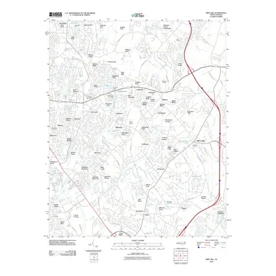
2010 Map of Mint Hill
USGS Topo · Published 2010About this map
Mint Hill sits as a central hub in this suburban landscape east of Charlotte, defined by a dense network of residential subdivisions and winding creek beds. Significant local landmarks such as the Camp Stewart military area and the Wilgrove Air Park anchor the northern and eastern portions of the quadrangle. The map reveals the extensive growth of the era through named communities like Hickory Grove, Wilgrove, and Olde Savannah. Water plays a key role in the local geography, with numerous small impoundments like McEwen Lake and Walhill Lake dotting the drainages of Goose Creek and McAlpine Creek. For those tracing local heritage, the map identifies established sites such as the Robinson Church Community, Evergreen Cemetery, and the Thompson Plantation.
Find a feature on this map
117 named features on this map. Tap any name to fly to it.
Don’t see what you’re looking for? This feature index may not catch every label — zoom into the map to look around manually.
Map Details
Editions of this 2010 Mint Hill Map
This is the sole edition of this map. No revisions or reprints were ever made.
Other maps of this area

1905 · Charlotte
USGS Topo · 1:48,000

1907 · Charlotte
USGS Topo · 1:62,500

1941 · Charlotte
USGS Topo · 1:125,000

1942 · Charlotte
USGS Topo · 1:125,000

1948 · Derita
USGS Topo · 1:24,000

1948 · Charlotte East
USGS Topo · 1:24,000

1949 · Charlotte East
USGS Topo · 1:24,000

1949 · Harrisburg
USGS Topo · 1:24,000

1949 · Wilgrove
USGS Topo · 1:24,000

1949 · Midland
USGS Topo · 1:24,000