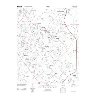
2013 Map of Mint Hill
USGS Topo · Published 2013About this map
Wilgrove Air Park and the surrounding residential developments define the landscape of eastern Mecklenburg County during this period of suburban maturation. The map illustrates a dense network of neighborhoods, including Hickory Grove, Lake Forest, and Olde Savannah, which replaced former agricultural tracts as the Charlotte metropolitan area expanded. Several water bodies, such as Waverly Lake, Delta Lake, and McEwen Lake, are integrated into these planned communities, serving as central landmarks for local residents. The drainage patterns of Goose Cr and McAlpine Cr provide a natural contrast to the structured grid of the suburbs. Transportation is anchored by major corridors like 485, which facilitate the connection between the established Wilgrove area and the outlying Robinson Church Community. This survey documents the transition of the region from rural crossroads into a fully realized residential corridor.
Find a feature on this map
77 named features on this map. Tap any name to fly to it.
Don’t see what you’re looking for? This feature index may not catch every label — zoom into the map to look around manually.
Map Details
Editions of this 2013 Mint Hill Map
This is the sole edition of this map. No revisions or reprints were ever made.
Other maps of this area

1905 · Charlotte
USGS Topo · 1:48,000

1907 · Charlotte
USGS Topo · 1:62,500

1941 · Charlotte
USGS Topo · 1:125,000

1942 · Charlotte
USGS Topo · 1:125,000

1948 · Derita
USGS Topo · 1:24,000

1948 · Charlotte East
USGS Topo · 1:24,000

1949 · Charlotte East
USGS Topo · 1:24,000

1949 · Harrisburg
USGS Topo · 1:24,000

1949 · Wilgrove
USGS Topo · 1:24,000

1949 · Midland
USGS Topo · 1:24,000