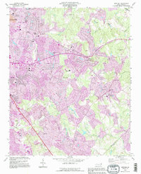
1993 Map of Mint Hill
USGS Topo · Published 1996About this map
Wilgrove Air Park and the surrounding residential developments of eastern Mecklenburg County define this landscape during a period of rapid suburbanization. The map documents the expansion of Charlotte through neighborhoods like Marlwood Acres and Idlewild, while still retaining the religious and social foundations of older rural communities. Numerous local landmarks are preserved in the data, including Philadelphia Ch and Bain Sch in Mint Hill, alongside the emerging recreational footprint of Larkhaven Golf Club and Pine Lake Country Club. A significant portion of the road network, including areas near Albemarle Rd, is marked as Under Construction, signaling the infrastructure shift as the region moved toward the turn of the century. Genealogists will find value in the detailed locations of burial sites like Sunset Memory Gardens and the Red Branch Cem.
Find a feature on this map
64 named features on this map. Tap any name to fly to it.
Don’t see what you’re looking for? This feature index may not catch every label — zoom into the map to look around manually.
Map Details
Editions of this 1993 Mint Hill Map
This is the sole edition of this map. No revisions or reprints were ever made.
Other maps of this area

1905 · Charlotte
USGS Topo · 1:48,000

1907 · Charlotte
USGS Topo · 1:62,500

1941 · Charlotte
USGS Topo · 1:125,000

1942 · Charlotte
USGS Topo · 1:125,000

1948 · Derita
USGS Topo · 1:24,000

1948 · Charlotte East
USGS Topo · 1:24,000

1949 · Charlotte East
USGS Topo · 1:24,000

1949 · Harrisburg
USGS Topo · 1:24,000

1949 · Wilgrove
USGS Topo · 1:24,000

1949 · Midland
USGS Topo · 1:24,000