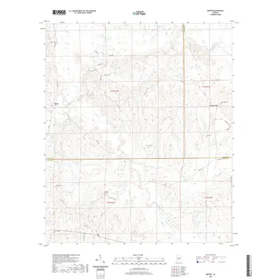
2020 Map of Minter
USGS Topo · Published 2020About this map
Minter and Farmersville anchor this rural landscape in Alabama's Black Belt, where the boundary between Dallas, Lowndes, and Wilcox counties converges. The map reveals a high concentration of family and community burial grounds, such as Purefoy Cem, McColough Cem, and Soles Cem, which offer significant value for genealogists tracing local lineage. The terrain is defined by a dense network of waterways, including the winding Cedar Cr and Dry Cedar Cr, alongside several smaller tributaries like Wagontongue Cr and Honey Cr. These streams carve through the countryside, dictating the placement of historic routes such as Farmersville Rd and Old Barge Mill Rd. The presence of both Snow Hill Cem and Old Snow Hill Cem suggests the shifting center of a local community over generations, while the inclusion of R Cullpepper Lake highlights modern water management and property landmarks in this agricultural region.
Find a feature on this map
47 named features on this map. Tap any name to fly to it.
Don’t see what you’re looking for? This feature index may not catch every label — zoom into the map to look around manually.
Map Details
Editions of this 2020 Minter Map
This is the sole edition of this map. No revisions or reprints were ever made.
Other maps of this area

1953 · Montgomery
USGS Topo · 1:250,000

1953 · Andalusia
USGS Topo · 1:250,000

1956 · Montgomery
USGS Topo · 1:250,000

1957 · Montgomery
USGS Topo · 1:250,000

1957 · Andalusia
USGS Topo · 1:250,000

1957 · Carlowville
USGS Topo · 1:62,500

1957 · Braggs
USGS Topo · 1:62,500

1975 · Carlowville NE
USGS Topo · 1:24,000
1981 · Oak Hill
USGS Topo · 1:24,000

1981 · Pine Apple North
USGS Topo · 1:24,000