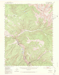
1950 Map of Minturn
USGS Topo · Published 1966About this map
Minturn and the surrounding Eagle River valley define this mid-century survey of Colorado’s high country. The local economy and settlement patterns are clearly anchored by the Denver and Rio Grande Western Railroad, which snakes through the steep canyons connecting Dowds and the mining-focused communities of Gilman, Belden, and Red Cliff. The presence of the Liberty Mine (Aband) and a Sawmill near Mill Creek indicates the industrial activity that sustained these precarious mountain towns.
Find a feature on this map
71 named features on this map. Tap any name to fly to it.
Don’t see what you’re looking for? This feature index may not catch every label — zoom into the map to look around manually.
Map Details
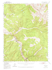
Editions of this 1950 Minturn Map
3 editions found

Other maps of this area

1889 · Leadville
USGS Topo · 1:125,000

1891 · Leadville
USGS Topo · 1:125,000

1909 · Mount Jackson
USGS Topo · 1:125,000

1911 · Mount Jackson
USGS Topo · 1:125,000

1929 · Dillon
USGS Topo · 1:62,500

1933 · Mt. Powell
USGS Topo · 1:48,000

1933 · Ute Peak
USGS Topo · 1:62,500

1934 · Climax
USGS Topo · 1:48,000

1934 · Minturn
USGS Topo · 1:62,500

1934 · Dillon
USGS Topo · 1:62,500