
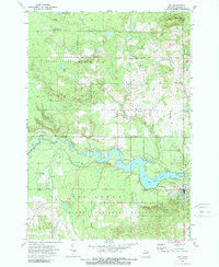
1972 Map of Mio
USGS Topo · Published 1975About this map
The Au Sable River carves a winding path through this central Michigan landscape, defining the northern border of the Huron National Forest. In the early 1970s, the community of Mio serves as a hub for both public utility and recreation, centered on the Mio Dam Pond and the Mio Au Sable Sch. Local infrastructure includes the Mio Airport and a nostalgic Drive-in Theater just south of the river, while the surrounding timberlands are marked by an Old Railroad Grade and the Kneeland Road corridor.
Find a feature on this map
43 named features on this map. Tap any name to fly to it.
Don’t see what you’re looking for? This feature index may not catch every label — zoom into the map to look around manually.
Map Details
Editions of this 1972 Mio Map
2 editions found
Other maps of this area

1949 · Lewiston
USGS Topo · 1:62,500

1950 · Comstock Hills
USGS Topo · 1:24,000

1951 · Comstock Hills
USGS Topo · 1:24,000

1954 · Traverse City
USGS Topo · 1:250,000

1955 · Comins
USGS Topo · 1:62,500

1958 · Traverse City
USGS Topo · 1:250,000

1963 · Luzerne
USGS Topo · 1:24,000

1963 · Red Oak
USGS Topo · 1:24,000

1972 · Mack Lake
USGS Topo · 1:24,000
1972 · Island Lake
USGS Topo · 1:24,000