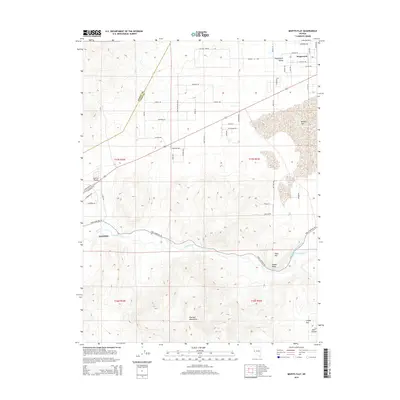
2014 Map of Misfits Flat
USGS Topo · Published 2014About this map
The Carson River flows across this Nevada landscape, winding through a corridor defined by irrigation works like Koch Ditch and the Houghman and Howard Ditch. The terrain transitions from the low expanse of Carson Plains and the namesake Misfits Flat to the elevated southern ridges of the Pine Nut Mountains. Small-scale residential developments are evident in Stagecoach and Stagecoach Valley, where a network of roads with names like Cimarron Trl and Navajo Trl suggests mid-to-late 20th-century rural planning. Along the western edge, the outskirts of Dayton meet the river valley near prominent landforms such as Table Mtn and Susans Bluff. The map clearly illustrates the relationship between the river and the emerging settlement patterns in Lyon and Storey counties during the early 21st century.
Find a feature on this map
33 named features on this map. Tap any name to fly to it.
Don’t see what you’re looking for? This feature index may not catch every label — zoom into the map to look around manually.
Map Details
Editions of this 2014 Misfits Flat Map
This is the sole edition of this map. No revisions or reprints were ever made.
Other maps of this area

1891 · Carson
USGS Topo · 1:125,000

1891 · Wabuska
USGS Topo · 1:125,000

1893 · Carson
USGS Topo · 1:125,000

1894 · Wabuska
USGS Topo · 1:125,000

1950 · Virginia City
USGS Topo · 1:62,500

1952 · Virginia City
USGS Topo · 1:62,500

1956 · Dayton
USGS Topo · 1:62,500

1957 · Como
USGS Topo · 1:62,500

1957 · Churchill Butte
USGS Topo · 1:62,500

1957 · Reno
USGS Topo · 1:250,000