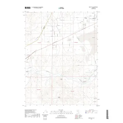
2018 Map of Misfits Flat
USGS Topo · Published 2018About this map
Stagecoach and the surrounding Stagecoach Valley serve as the primary residential hub in this corner of Lyon County, where modern subdivision streets like Stallion Springs Cir and Shawnee Rd meet the historic path of the California Emigrant Trl. The landscape is defined by the sharp transition from the residential flats into the varied topography of the Pine Nut Mountains to the south. Water management remains central to the region's character, with the Carson River flanked by agricultural infrastructure such as Koch Ditch and the Houghman and Howard Ditch. Strategic high points like Fremont Lookout and Susans Bluff overlook the expansive Misfits Flat, while Fort Churchill Rd provides a historical transit link through the Twelve Mile Desert toward the western Carson Plains.
Find a feature on this map
44 named features on this map. Tap any name to fly to it.
Don’t see what you’re looking for? This feature index may not catch every label — zoom into the map to look around manually.
Map Details
Editions of this 2018 Misfits Flat Map
This is the sole edition of this map. No revisions or reprints were ever made.
Other maps of this area

1891 · Carson
USGS Topo · 1:125,000

1891 · Wabuska
USGS Topo · 1:125,000

1893 · Carson
USGS Topo · 1:125,000

1894 · Wabuska
USGS Topo · 1:125,000

1950 · Virginia City
USGS Topo · 1:62,500

1952 · Virginia City
USGS Topo · 1:62,500

1956 · Dayton
USGS Topo · 1:62,500

1957 · Como
USGS Topo · 1:62,500

1957 · Churchill Butte
USGS Topo · 1:62,500

1957 · Reno
USGS Topo · 1:250,000