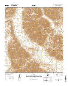
2015 Map of Misheguk Mountain B-3 SE
USGS Topo · Published 2015About this map
The Noatak National Preserve encompasses most of this landscape, where high-altitude drainages and topographic divides define the geography of the North Slope. A significant geographic transition is visible at Amaktukvik Pass, a high mountain corridor that connects different watershed systems. The western portion of the map is dominated by the Kaluktavik River, which flows southward through the valleys. The intricate network of Tumit Cr tributaries illustrates the complex erosion patterns and drainage basins characteristic of this protected wilderness area. This 2015 survey documents the undisturbed landforms of the Brooks Range foothills, providing a clear record of the area's hydrology and land-management boundaries within the preserve.
Find a feature on this map
11 named features on this map. Tap any name to fly to it.
Don’t see what you’re looking for? This feature index may not catch every label — zoom into the map to look around manually.
Map Details
Editions of this 2015 Misheguk Mountain B-3 SE Map
This is the sole edition of this map. No revisions or reprints were ever made.
Other maps of this area

1951 · Misheguk Mountain
USGS Topo · 1:250,000

1955 · Misheguk Mountain A-3
USGS Topo · 1:63,360

1956 · Misheguk Mountain
USGS Topo · 1:250,000
1990 · Misheguk Mountain B-2
USGS Topo · 1:63,360
1990 · Misheguk Mountain A-2
USGS Topo · 1:63,360
1990 · Misheguk Mountain B-3
USGS Topo · 1:63,360
2015 · Misheguk Mountain B-3 NW
USGS Topo · 1:25,000
2015 · Misheguk Mountain B-3 SW
USGS Topo · 1:25,000
2015 · Misheguk Mountain A-2 NW
USGS Topo · 1:25,000
2015 · Misheguk Mountain B-2 SW
USGS Topo · 1:25,000