
1955 Map of Misheguk Mountain A-3
USGS Topo · Published 1967About this map
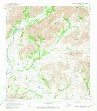
The Misheguk Mountains dominate this 1955 survey of the Northwest Arctic, revealing a landscape defined by sharp elevation and a complex network of glacial-fed waterways. This remote section of the North Slope Borough shows the branching headwaters of the Kaluktavik River and Katuktavik River, which carve deep valleys through the surrounding peaks. The topography is further shaped by the Imikneyak Mountains and the Kingasivik Mountains, providing a detailed look at the drainage patterns of the Imikneyak Creek system. To the south, the Isacheluich Mountains border the drainages of Sisiak Creek and Analak Cr, marking a high-altitude wilderness where no roads or trails were recorded at the time of the field annotation.
Find a feature on this map
10 named features on this map. Tap any name to fly to it.
Don’t see what you’re looking for? This feature index may not catch every label — zoom into the map to look around manually.
Map Details
Editions of this 1955 Misheguk Mountain A-3 Map
2 editions found
Other maps of this area

1951 · Baird Mountains
USGS Topo · 1:250,000

1951 · Misheguk Mountain
USGS Topo · 1:250,000

1955 · Baird Mountains D-4
USGS Topo · 1:63,360

1955 · Baird Mountains D-3
USGS Topo · 1:63,360
1955 · Misheguk Mountain A-4
USGS Topo · 1:63,360

1956 · Misheguk Mountain
USGS Topo · 1:250,000

1956 · Baird Mountains
USGS Topo · 1:250,000

1965 · Baird Mountains
USGS Topo · 1:250,000
1990 · Misheguk Mountain B-2
USGS Topo · 1:63,360
1990 · Misheguk Mountain A-2
USGS Topo · 1:63,360