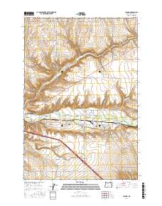
2017 Map of Mission
USGS Topo · Published 2017About this map
The Umatilla River valley serves as the primary corridor for settlement and transit in this region of eastern Oregon, where the city of Pendleton expands into the surrounding plateaus. The landscape is defined by the convergence of several drainages, including Wildhorse Cr from the north and Patawa Cr from the south, cutting through the high country. Local heritage is deeply rooted in the community of Mission and the plateau known as Gopher Flats.
Find a feature on this map
52 named features on this map. Tap any name to fly to it.
Don’t see what you’re looking for? This feature index may not catch every label — zoom into the map to look around manually.
Map Details
Editions of this 2017 Mission Map
This is the sole edition of this map. No revisions or reprints were ever made.
Other maps of this area

1935 · Pendleton
USGS Topo · 1:125,000

1953 · Pendleton
USGS Topo · 1:250,000

1956 · Pendleton
USGS Topo · 1:250,000

1966 · Cabbage Hill
USGS Topo · 1:24,000

1966 · Mc Kay Reservoir
USGS Topo · 1:24,000
1966 · Adams
USGS Topo · 1:24,000
1966 · Cayuse
USGS Topo · 1:24,000

1966 · Holdman SE
USGS Topo · 1:24,000

1966 · Table Rock
USGS Topo · 1:24,000

1966 · Pendleton
USGS Topo · 1:24,000