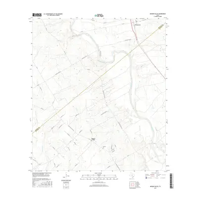
2016 Map of Mission Valley
USGS Topo · Published 2016About this map
The Guadalupe River winds through the heart of this DeWitt and Victoria County borderland, shaping a landscape defined by its creek drainage and rural crossroads. The settlement of Thomaston sits at a critical junction in the north, where Price Creek meets the river valley, while Mission Valley serves as a central hub for the surrounding ranchlands. The area's genealogical and local history is anchored by the Guadalupe Cem, located near the intersection of Reinecke Road and Mission Bell Road. This 2016 survey illustrates a traditional Texas rural layout, where named family lanes and ranch roads like Albrecht Road, Moritz Lane, and Lassman Lane branch out from established routes such as the Thomaston River Road. The complex network of waterways, including Twentymile Creek and Rocky Creek, reveals the natural hydrology that has dictated land use in this region for generations.
Find a feature on this map
47 named features on this map. Tap any name to fly to it.
Don’t see what you’re looking for? This feature index may not catch every label — zoom into the map to look around manually.
Map Details
Editions of this 2016 Mission Valley Map
This is the sole edition of this map. No revisions or reprints were ever made.
Other maps of this area

1953 · Beeville
USGS Topo · 1:250,000

1953 · Seguin
USGS Topo · 1:250,000

1956 · Beeville
USGS Topo · 1:250,000

1958 · Seguin
USGS Topo · 1:250,000

1960 · Beeville
USGS Topo · 1:250,000

1960 · Cuero
USGS Topo · 1:24,000

1962 · Verhelle
USGS Topo · 1:24,000

1963 · Fordtran
USGS Topo · 1:24,000

1963 · Meyersville
USGS Topo · 1:24,000

1963 · Nursery
USGS Topo · 1:24,000