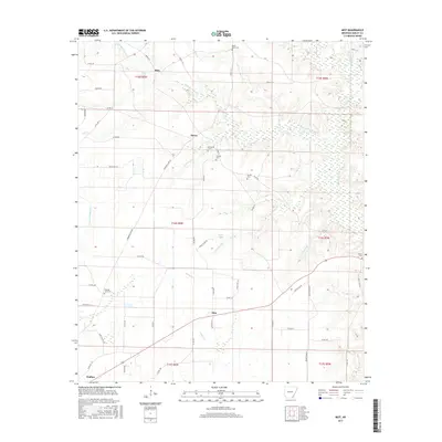
2017 Map of Mist
USGS Topo · Published 2017About this map
Mist serves as the central hub of this South Arkansas landscape, where the local road network converges near the banks of Haley Cr. The terrain is defined by a complex system of waterways, including Bearhouse Cr and its tributaries, which create a mosaic of wetlands and drainage patterns across the Ashley County countryside. This 2017 survey reveals a rural settlement pattern anchored by small communities and family-named landmarks like Riley and Berea.
Find a feature on this map
63 named features on this map. Tap any name to fly to it.
Don’t see what you’re looking for? This feature index may not catch every label — zoom into the map to look around manually.
Map Details
Editions of this 2017 Mist Map
This is the sole edition of this map. No revisions or reprints were ever made.
Other maps of this area

1935 · Mist
USGS Topo · 1:62,500

1935 · Wilmot
USGS Topo · 1:62,500

1952 · Fountain Hill
USGS Topo · 1:24,000

1953 · Greenwood
USGS Topo · 1:250,000

1956 · Greenwood
USGS Topo · 1:250,000

1960 · Snyder
USGS Topo · 1:24,000

1960 · Mist
USGS Topo · 1:62,500

1960 · Wilmot
USGS Topo · 1:62,500
1960 · Portland
USGS Topo · 1:24,000

1960 · Wilmot NW
USGS Topo · 1:24,000