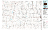
1986 Map of Mitchell
USGS Topo · Published 1989About this map
Firesteel Creek and Enemy Creek wind through this central South Dakota landscape, defining the agricultural and water management patterns of the mid-1980s. The city of Mitchell dominates the eastern portion of the sheet, situated near the James River, while the transit corridor of Highway 16 and Interstate 90 connects it to western settlements like Plankinton, White Lake, and Kimball. This survey reveals a landscape heavily dedicated to conservation and wildlife management, with numerous designated areas such as the State Game Production Area and National Waterfowl Production Area scattered across the township grid.
Find a feature on this map
103 named features on this map. Tap any name to fly to it.
Don’t see what you’re looking for? This feature index may not catch every label — zoom into the map to look around manually.
Map Details
Editions of this 1986 Mitchell Map
2 editions found
Other maps of this area

1898 · Olivet
USGS Topo · 1:125,000

1898 · Huron
USGS Topo · 1:125,000

1899 · Mitchell
USGS Topo · 1:125,000

1899 · Alexandria
USGS Topo · 1:125,000

1899 · De Smet
USGS Topo · 1:125,000

1941 · Pukwana
USGS Topo · 1:62,500

1941 · Kimball North
USGS Topo · 1:62,500

1942 · Crow Lake
USGS Topo · 1:62,500

1951 · Pukwana
USGS Topo · 1:62,500

1951 · Kimball North
USGS Topo · 1:62,500