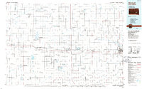
1986 Map of Mitchell
USGS Topo · Published 1986About this map
Mitchell serves as the regional hub on this mid-1980s survey, anchoring an expansive agricultural landscape defined by the Burlington Northern railroad corridor. The map details the transition from early prairie settlement to an organized network of townships such as Plummer, Eureka, and Bristol. Key institutional landmarks are noted, including the State Training Sch near Plankinton, and the Sunset Memorial Cem on the outskirts of Mitchell.
Find a feature on this map
104 named features on this map. Tap any name to fly to it.
Don’t see what you’re looking for? This feature index may not catch every label — zoom into the map to look around manually.
Map Details
Editions of this 1986 Mitchell Map
2 editions found
Other maps of this area

1898 · Olivet
USGS Topo · 1:125,000

1898 · Huron
USGS Topo · 1:125,000

1899 · Mitchell
USGS Topo · 1:125,000

1899 · Alexandria
USGS Topo · 1:125,000

1899 · De Smet
USGS Topo · 1:125,000

1941 · Pukwana
USGS Topo · 1:62,500

1941 · Kimball North
USGS Topo · 1:62,500

1942 · Crow Lake
USGS Topo · 1:62,500

1951 · Pukwana
USGS Topo · 1:62,500

1951 · Kimball North
USGS Topo · 1:62,500