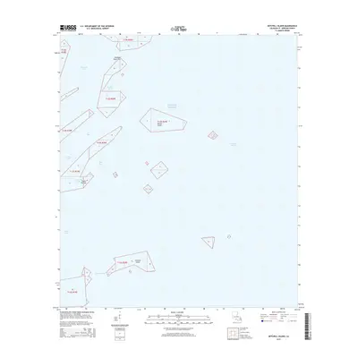
2015 Map of Mitchell Island
USGS Topo · Published 2015About this map
Mitchell Island and the surrounding marshlands of Saint Bernard Parish dominate this coastal survey, where the Louisiana landscape dissolves into the Gulf of Mexico. The area is defined by a complex network of estuarine features, including Cranetown Bay and Drum Bay, illustrating the fragile state of the outer delta. Small landmasses such as Martin Island and Turtle Pen Isle stand as remnants of the shifting coastal geography, separated by narrow navigable channels like Keelboat Pass and Elephant Point Pass. This 2015 study by the U.S. Geological Survey provides a precise view of the hydrography of Chandeleur Sound, tracing the intricate curves of Redfish Bend and the sheltered waters of Conkey Cove. The absence of roads or permanent structures reflects the maritime nature of this wilderness at the edge of the Mississippi River delta system.
Find a feature on this map
18 named features on this map. Tap any name to fly to it.
Don’t see what you’re looking for? This feature index may not catch every label — zoom into the map to look around manually.
Map Details
Editions of this 2015 Mitchell Island Map
This is the sole edition of this map. No revisions or reprints were ever made.
Other maps of this area

1893 · Cat Island
USGS Topo · 1:62,500

1893 · Chandeleur
USGS Topo · 1:62,500

1893 · Toulme
USGS Topo · 1:62,500

1895 · Bodreau
USGS Topo · 1:62,500

1935 · Morgan Harbor
USGS Topo · 1:31,680

1935 · Mitchell Keys
USGS Topo · 1:31,680

1946 · Oak Mound Bayou
USGS Topo · 1:31,680
1949 · Drum Bay
USGS Topo · 1:31,680
1949 · Door Point
USGS Topo · 1:31,680

1953 · Mobile
USGS Topo · 1:250,000