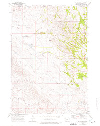
1972 Map of Mitten Butte
USGS Topo · Published 1975About this map
Mitten Butte stands as a central landmark in this high plains landscape along the Wyoming and Montana border during the early 1970s. The region is defined by a ranching and energy-extraction economy, with the Trail Creek Ranch and a local Rodeo Ground situated near the headwaters of Trail Creek. Evidence of water management in this arid environment is visible through the Gary Reservoir and Donna Reservoir, which support livestock across the broken terrain of the Prairie Dog Hills.
Find a feature on this map
18 named features on this map. Tap any name to fly to it.
Don’t see what you’re looking for? This feature index may not catch every label — zoom into the map to look around manually.
Map Details
Editions of this 1972 Mitten Butte Map
This is the sole edition of this map. No revisions or reprints were ever made.
Other maps of this area

1954 · Ekalaka
USGS Topo · 1:250,000

1954 · Gillette
USGS Topo · 1:250,000

1955 · Gillette
USGS Topo · 1:250,000

1956 · Ekalaka
USGS Topo · 1:250,000

1958 · Gillette
USGS Topo · 1:250,000

1958 · Ekalaka
USGS Topo · 1:250,000

1962 · Gillette
USGS Topo · 1:250,000

1965 · Ekalaka
USGS Topo · 1:250,000
1970 · Belle Creek South
USGS Topo · 1:24,000

1970 · Belle Creek SW
USGS Topo · 1:24,000