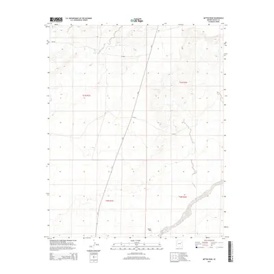
2014 Map of Mitten Peak
USGS Topo · Published 2014About this map
Mitten Peak rises above the high desert floor, serving as a prominent landmark in this 2014 survey of northeastern Arizona. The landscape is defined by the ephemeral drainage of Leroux Wash, which cuts across the southern portion of the quadrangle. Transport through this high-plateau environment is primarily facilitated by the North-South corridor of Az-77 and a network of Bureau of Indian Affairs routes, including Bia-6 and Bia-9860. A notable hydrological feature, Salt Seeps, appears in the northern reaches, indicating the presence of mineralized springs. The map detail reflects a sparsely populated region within the Fort Defiance Agency, characterized by open space and limited infrastructure, largely organized by the Public Land Survey System boundaries of t21n r21e and its neighboring townships.
Find a feature on this map
11 named features on this map. Tap any name to fly to it.
Don’t see what you’re looking for? This feature index may not catch every label — zoom into the map to look around manually.
Map Details
Editions of this 2014 Mitten Peak Map
This is the sole edition of this map. No revisions or reprints were ever made.
Other maps of this area

1883 · Tusayan
USGS Topo · 1:250,000

1886 · Tusayan
USGS Topo · 1:250,000

1886 · Fort Defiance
USGS Topo · 1:250,000

1892 · Fort Defiance
USGS Topo · 1:250,000

1947 · Flagstaff
USGS Topo · 1:250,000

1954 · Flagstaff
USGS Topo · 1:250,000

1954 · Gallup
USGS Topo · 1:250,000

1958 · Gallup
USGS Topo · 1:250,000

1958 · Flagstaff
USGS Topo · 1:250,000

1959 · Gallup
USGS Topo · 1:250,000