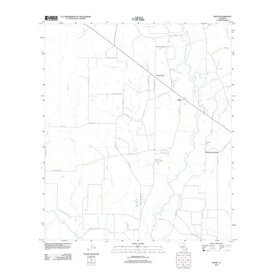
2012 Map of Mittie
USGS Topo · Published 2012About this map
Simmons Settlement and the surrounding piney woods of Allen Parish are defined by the winding course of Whisky Chitto Cr and its many tributaries. In the early 2010s, this landscape maintained a quiet, rural character punctuated by small communities like Mittie and Cherry Grove. The area's geography is intricately carved by water, with Flat Cr, Tenmile Cr, and Bundick Cr creating a network of drainage across the low-lying terrain. For genealogists and local historians, the Simmons Cem serves as a vital anchor for the families who settled this portion of the Louisiana interior. Industry also leaves its mark here via the North Mittie Gas Field and the Harmony Canal, illustrating how the local economy has historically integrated natural resource extraction with the management of the region's abundant water resources.
Find a feature on this map
54 named features on this map. Tap any name to fly to it.
Don’t see what you’re looking for? This feature index may not catch every label — zoom into the map to look around manually.
Map Details
Editions of this 2012 Mittie Map
This is the sole edition of this map. No revisions or reprints were ever made.
Other maps of this area

1935 · Mittie
USGS Topo · 1:31,680

1947 · Oberlin
USGS Topo · 1:31,680

1947 · Pine Chapel
USGS Topo · 1:31,680

1947 · Le Blanc
USGS Topo · 1:31,680

1947 · Reeves
USGS Topo · 1:31,680

1947 · Elizabeth
USGS Topo · 1:31,680

1947 · Grant
USGS Topo · 1:31,680

1947 · Bundick
USGS Topo · 1:31,680

1947 · Sugartown
USGS Topo · 1:31,680

1948 · Grant
USGS Topo · 1:24,000