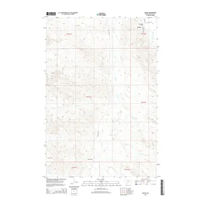
2014 Map of Mizpah
USGS Topo · Published 2014About this map
Mizpah serves as the focal point for this section of Custer County, situated near the northeastern corner where the Powder River Bridge facilitates travel over the water. The landscape is defined by a dense network of drainages and seasonal creek beds, including Mizpah Cr, Fivemile Cr, and Russell Cr, which carve through the undulating terrain. To the south, the topography drops into the aptly named Hells Gulch and is further divided by numerous smaller tributaries such as Double Corral Cr and Fessler Cr.
Find a feature on this map
23 named features on this map. Tap any name to fly to it.
Don’t see what you’re looking for? This feature index may not catch every label — zoom into the map to look around manually.
Map Details
Editions of this 2014 Mizpah Map
This is the sole edition of this map. No revisions or reprints were ever made.
Other maps of this area

1953 · Miles City
USGS Topo · 1:250,000

1957 · Miles City
USGS Topo · 1:250,000

1958 · Miles City
USGS Topo · 1:250,000

1969 · Mizpah
USGS Topo · 1:24,000

1969 · Loaf of Bread Butte
USGS Topo · 1:24,000

1969 · Forty Creek
USGS Topo · 1:24,000

1969 · Locate SE
USGS Topo · 1:24,000

1969 · Miles City Creek
USGS Topo · 1:24,000
1969 · Pennock Creek
USGS Topo · 1:24,000
1969 · Red Knob
USGS Topo · 1:24,000