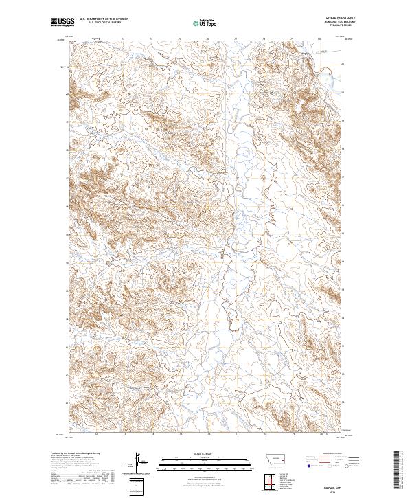
2024 Map of Mizpah
USGS Topo · Published 2024About this map
Mizpah sits at a critical junction in Custer County where local drainage systems meet the southward-flowing Powder River. This high plains landscape is defined by its complex hydrology, with numerous named seasonal waterways such as Fivemile Creek, Russell Creek, and M S Creek carving through the terrain. The network of rural routes, including Trail Creek Rd and Mizpah Rd, provides a skeletal structure for the isolated ranching community, tracing the contours of the land rather than following a strict grid. Significant landmarks like Hells Gulch and Double Corral Creek point to the area's agricultural history and the practical naming conventions of early settlers. The township and range boundaries, such as t6n r52e, provide the legal framework for this remote section of Eastern Montana, reflecting a region where wide-open space is organized by water access and section lines.
Find a feature on this map
22 named features on this map. Tap any name to fly to it.
Don’t see what you’re looking for? This feature index may not catch every label — zoom into the map to look around manually.
Map Details
Editions of this 2024 Mizpah Map
This is the sole edition of this map. No revisions or reprints were ever made.
Other maps of this area

1953 · Miles City
USGS Topo · 1:250,000

1957 · Miles City
USGS Topo · 1:250,000

1958 · Miles City
USGS Topo · 1:250,000

1969 · Mizpah
USGS Topo · 1:24,000

1969 · Loaf of Bread Butte
USGS Topo · 1:24,000

1969 · Forty Creek
USGS Topo · 1:24,000

1969 · Locate SE
USGS Topo · 1:24,000

1969 · Miles City Creek
USGS Topo · 1:24,000
1969 · Pennock Creek
USGS Topo · 1:24,000
1969 · Red Knob
USGS Topo · 1:24,000