1983 Map of Moab
USGS Topo · Published 1983About this map
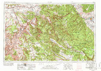
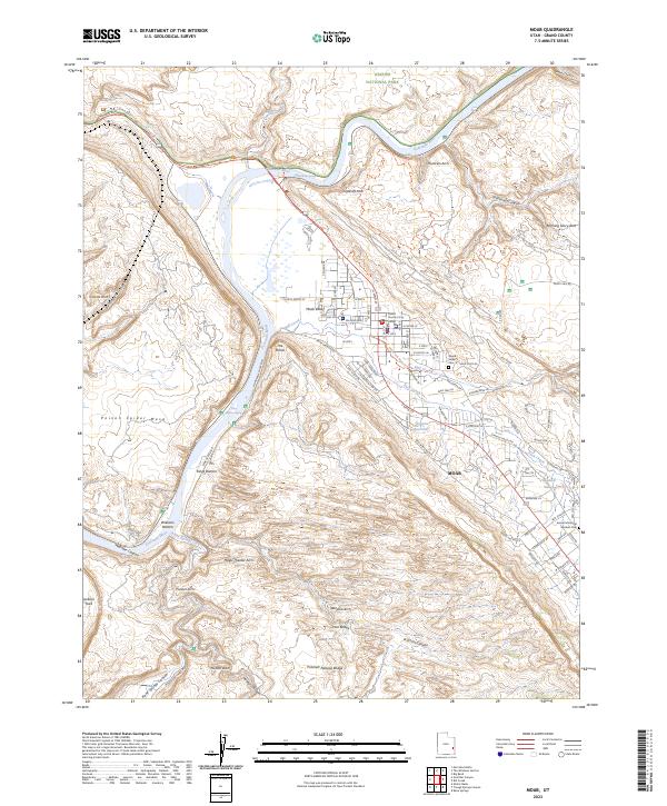
Arches National Park and the sandstone fins of The Windows Section dominate this early 1980s topography, showing a landscape defined by deep incisions from the Colorado River and Dolores River. The settlement of Moab serves as the central hub, situated near the southern edge of the map where Spanish Valley Creek meets the river. To the north, the Denver and Rio Grande Western railroad tracks follow the base of the Book Cliffs, connecting the high-desert outposts of Thompson, Cisco, and Sagers. This period reveals an active mineral economy in the red rock country, with Telluride Mines and the Cactus Rat Mine marking the extraction history of the Yellow Cat Flat. From the high vistas of Dead Horse Point to the monoliths of Courthouse Towers, the map details a region transitioning from industrial mining toward its identity as a recreational destination.
Find a feature on this map
71 named features on this map. Tap any name to fly to it.
Don’t see what you’re looking for? This feature index may not catch every label — zoom into the map to look around manually.
Map Details
Editions of this 1983 Moab Map
3 editions found
Historical Maps of Moab Through Time
10 maps found